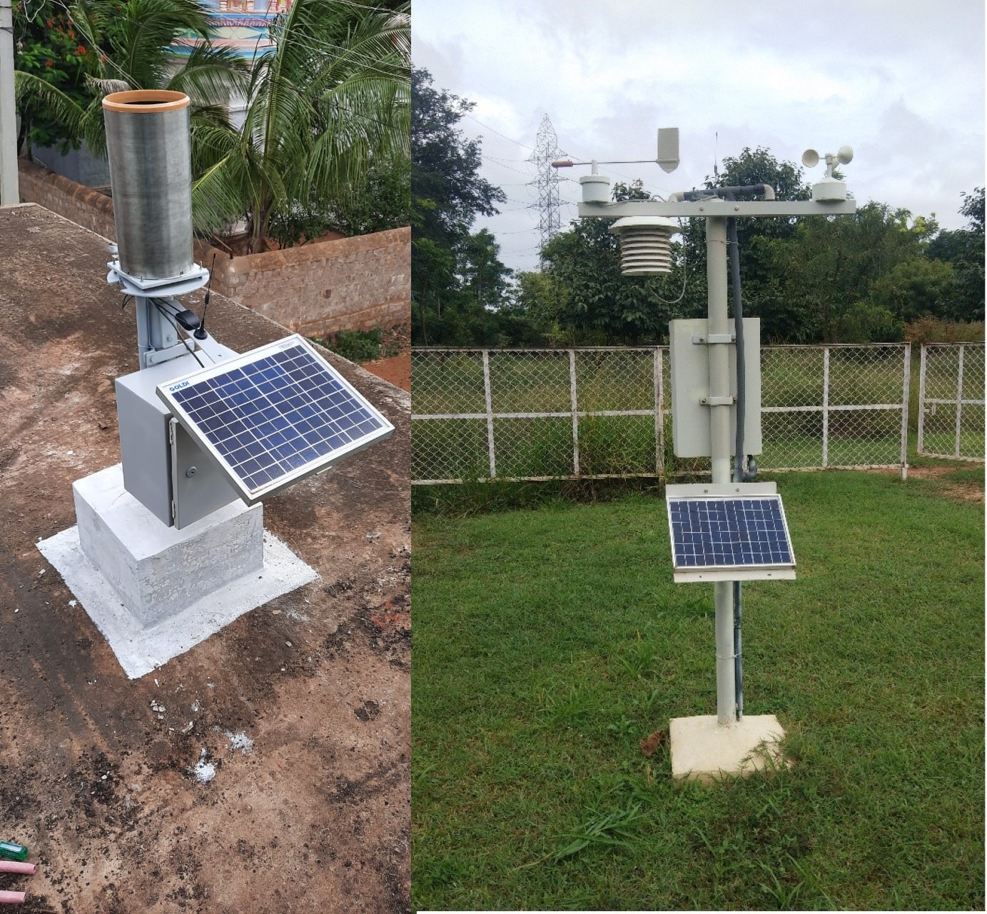
Weather monitoring is done with establishment of GPRS enabled and Solar Powered 6505 Telemetric Rain Gauges (TRG) and 935 Telemetric Weather Stations (TWS) to receive data at a resolution of 25 Sq. Km and 250 Sq. km respectively.
KSNDMC has designed and installed a dense network of Solar powered, GPRS enabled Telemetric Rain Gauge (TRG) stations covering all the Gram Panchayaths and Solar powered, GPRS enabled Telemetric Weather Stations (TWS) station at all the Hoblis.
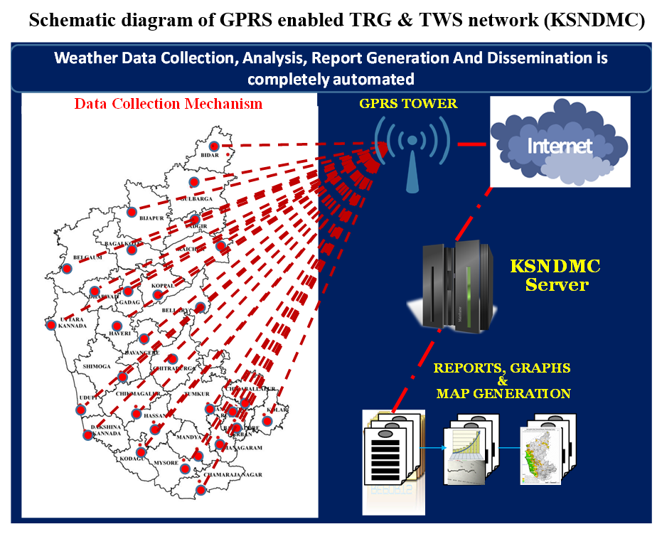
The near real time data received at central server, located at Master Control Facility, KSNDMC campus, at every 15 minutes from all the stations is been analysed and scientific reports prepared through auto-mode by using web-enabled application. The information and reports thus generated is been disseminated to the users through SMS, e-mail and 24x7x365 Help-Desk
Karnataka State Natural Disaster Monitoring Centre (KSNDMC), has taken up pioneering and pathbreaking initiatives towards monitoring natural disasters
...
and risk reduction. KSNDMC has established a network of GPRS enabled and solar-powered Telemetric Rain Gauges at all the 6,500 Grampanchayaths (25 sq. km each) and 923 Telemetric Weather Stations at all the 747 Hoblis (sub Tehsil :
200 sq. km each) and 176 Micro-Watersheds in the state. The weather data comprising Temperature
(⁰C), Relative Humidity (%), Wind Speed (m/s), Wind Direction (Degrees), Rainfall amount (mm) and
intensity (mm/hr) data has been collected at every 15 minutes through these weather monitoring
stations. The density of weather monitoring stations network is the highest and first of its kind in the
country. Also, the temporal resolution of the data collected (96 data points a day/station) through this
network of stations is a need of the hour for the researchers to develop simulations and related
advisories. The monitoring network can capture the highly erratic distribution of rainfall and weather
parameters both in terms of space and time, in turn it is helping the decision makers to take a timely
decision at the micro level.
The Centre has established a state-of-the-art facility to collect data at a very high spatial and temporal
resolution, data analysis, information and advisory generation and dissemination to the Stakeholders at
a near-real-time. Necessary computer/web applications have been indigenously developed to collect,
store, analyse and transmit reliable, accurate and seamless data with least manual intervention. As a
result, the time interval between data collection to decision-making is almost at a near-real-time. Based
on the near real-time data collected, the Centre identifies and maps the hazard vulnerable areas, prepares
reports with advisories and disseminate to stakeholders